
Some adventures could be considered a lesson in, "its not about the miles ridden but the places you go that few have ever been and the friends you have who are willing to indulge you in the routes you seek to to discover."
It all began with a race born to be the toughest race in the world and has died in the ashes of the legend, that is Montezuma's Revenge. In 24 hours racers would ride a potential 240 miles, climb 10 times over the Continental Divide, gain 37,000 in accumulated vertical feet, and climb a 14er; all at elevations between 10,000 and 14,000 ft. Fuggin hard, I think so.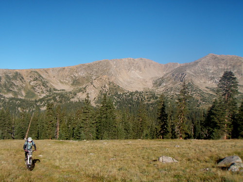
No one officially finished the entire 240 miles but to be considered a finisher of the race you had to climb(hike) Grays Peak from Ruby Gulch and descend(hike) into Horseshoe Basin, all along with your bike and wheels strapped to your back, after having 100 + miles in your legs. Ruby Gulch is the least used route to climb the infamous Grays Peak(14,270 ft) and perhaps the toughest. Like I said nothing about this race was easy so why take the easy way to Grays Peak.
This all leads to my route for this past weekend. My original intent was to ride up Ruby Gulch from Peru Creek and Chihuahua Gulch and then strap my bike to my back at the end of the trail(a little over 12,000 ft) and climb Grays Peak following the route the Montezuma's Revenge racers took. From there I intended to ride/hike my bike to Argentine Pass on the Continental Divide Trail some 3 miles from Grays and some thousand feet lower and from there descend the Argentine Pass trail to Horseshoe Basin and Peru Creek, making the route my own.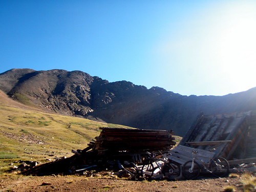
I knew Grays Peak was gonna be a hard push from the end of Ruby Gulch, what I didn't know was what the terrain was like on the CDT from Grays to Argentine Pass other then the fact that there were a few couple hundred feet climbs along with about a thousand feet of elevation loss in-between the two.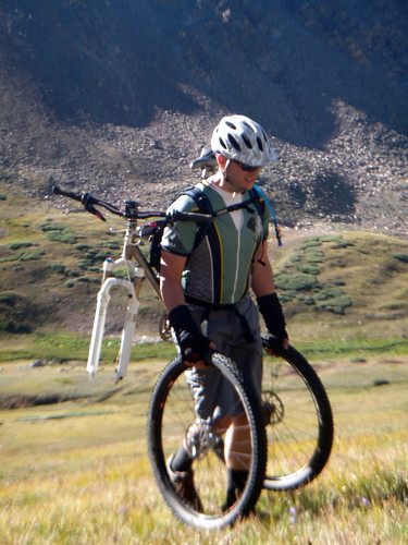
I knew my route was going to be stupid hard and maybe even undo-able in the time I had allowed myself since I had promised the lovely Missus Goat I would be home by early afternoon. So when it came down to inviting friends, I really didn't because I knew most of them would balk at the thought of hike a biking the southwest ridge of Grays Peak and even bailing on the route halfway through only to get a few miles of riding in for the day. Good ole Guacamole though, learned of my adventure and asked to come along saying he just wanted to be outdoors, it didn't really matter doing what.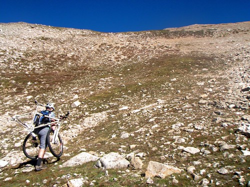
We met at 5am and made the drive to Montezuma, getting on bike a little before 7am after getting lost for a bit finding the trail-head. Once on the bike we climbed Peru Creek and after a few miles turned onto the slightly technical Chihuahua Gulch. A few miles of beautiful scenery brought us to Ruby Gulch. Ruby Gulch is unmarked and the entrance is basically a creek-bed making it a tough find if you don't know what your looking for. The 1st mile or so of Ruby Gulch is a well bedded double-track and after a few miles it disappear into indistinct two track up to 12,000 ft and an abandoned cabin and mine where it peters out.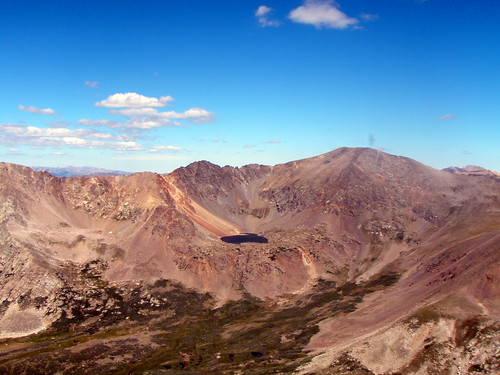
It was here that we exchanged our biking shoes for hiking shoes and strapped our bikes to our Camelbaks and started a due north hike up Grays Peak's southwest ridge. Immediately we recognized why the Montezuma's Revenge racers used framed packs to carry their bikes as our bikes presented an enormous load for which the Camelbaks were not designed for. This was causing the shoulder straps to bite into our shoulders and the chest strap to squeeze our chest making breathing even more difficult then it was at this elevation.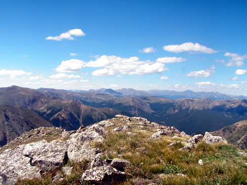
We hiked though and began a slow switchback up to the ridge. At some point Guacamole and myself separated, me taking the more north easterly route while he took the southwest. In the end he chose better route. While he hiked up Galapagos turtle sized boulders I got into a loose scree field that sifted and moved with every step, once making me slide 2 ft down the steep slope. Guacamole topped the ridge a good 10-15 minutes before I did and when I finally did, I dropped my pack and promptly dropped in a heap, just over 13,000 ft.
We sat there for a while staring at Grays Peak sitting somewhere around 1200 ft above our heads and at least 2 miles away. I think we had both given up making its summit with our bikes but we both considered leaving our bikes and hoofing it up to the top and coming back for our bikes. I asked Guacamole for the time. 11:30 am. If we were to make the summit which we figured would take at least another hour if not more I would be breaking my promise to my wife of an early afternoon arrival home. A little disappointed with myself, I suggested to Guacamole to hike back down and possibly ride up Lenawee if we had time and then shoot back to the car by 1pm.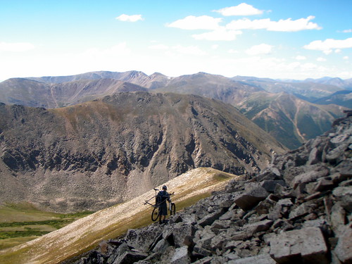
We hiked back down Guacamole's route for ascending the southwest ridge and as soon as we hit grassy tundra off the big ass turtle sized boulders I announced I was riding. Guacamole looked at me skeptically but I was not taking another step with that damned bike strapped to my back even if it meant letting it pull me down the hill.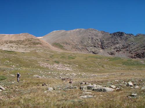
Once I had my wheels back on, I stepped over the bike and realized it was to steep to ride even trying to "switchback" the slope. So I took the next logical approach and went hiking straight down the slope using the rear brake of the bike to help control my hiking slide. I finally made it to a point that while still steep, was ridable and looked back up to see Guacamole far up the slope above me. I got on and rode to just above the Ruby Gulch Cabin and waited for Guacamole to catch up.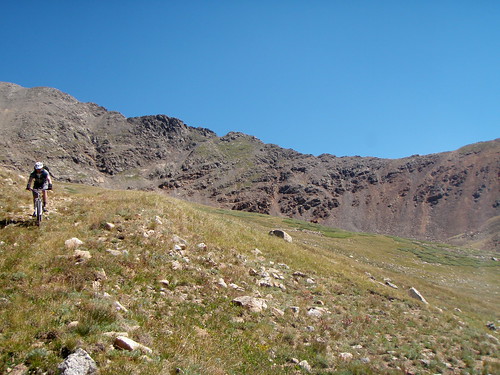
After bombing down Ruby Gulch to Chihuahua Gulch and Chihuahua Gulch to Peru Creek Road we picked up the Lenawee Trail. We rode/hiked up Lenawee Trail about a half mile or so and reached a trail to some dilapidated cabins and sat there quietly enjoying the serenity of the area. Finally we got back up, trekked another 1/4 mile or so to 11,000 ft and I declared I was done. Guacamole it seemed was done to, just not wanting to be the first to admit it.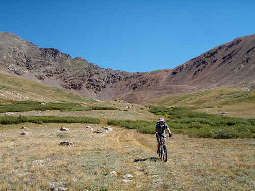
We turned around bombed down Lenawee and Peru Creek and called our adventurous day done. We didn't complete what we set out to do but the day was definitely full of its perks and it was an adventure that has pulled us into thinking about frame packs and the possibilities of an adventure for another day that just may include the same route, just this time, one we aim to complete.
Not All Failures End Without Triumph
Posted by The Evil MGE! Monday, August 23, 2010 at 11:17 PM
Subscribe to:
Post Comments (Atom)


5 comments:
August 23, 2010 at 11:40 PM
Ballsy! When I plan such things I go in figuring I might have to spend the night. Clear the schedule, etc. To plan this as a half day ride is beyond category!
August 23, 2010 at 11:50 PM
Don, I knew it might be a far chance. The Argentine grade from Silverplume to Horseshoe Basin then up Lenawee down to A Basin then up over Loveland Pass can be done in 7-12 hours. So I knew I'd be pushing it but it was a good exploratory ride and the search is on for a external frame pack for cheap.
August 24, 2010 at 8:02 AM
Instead of a frame pack, think about using something like a M60 sling that will support the weight of the bike and use your existing Camelbak as a cushion.
August 24, 2010 at 9:15 AM
In my experience sligs are a bad way to go. Too much weight load on one shoulder and without a means to secure a heavy cumbersome load it can sift easily at the most inopportune time(climbing a steep mtn). Frame packs carry most of the load on the hips with the shoulderstraps being a means to stablize the load. This is also the way the Montezuma racers did it during the race.
October 17, 2010 at 11:23 PM
MGE is right - you gotta use a framepack - works like a charm. I did this race the final year in 2006. Crazy to attempt this for a "social ride" - nice work. It is totally do-able and worthy. Give yourself a full day and you'll be riding down the backside like the downhiller who passed me in the race after slogging his heavy rig up without a pack. Kathryn
Post a Comment